Project Archive
Year: 2022
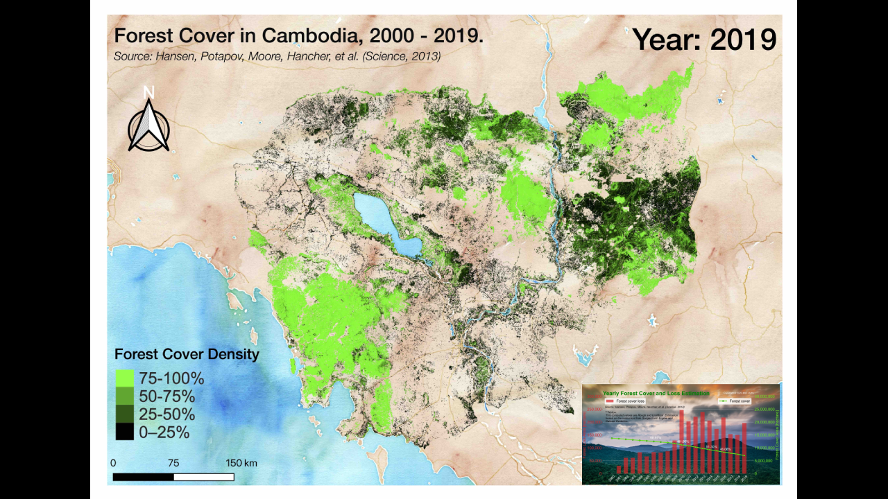
Cambodia Forest Cover Change 2000-2019
Our GIS consultant engineers master the geo-spatial information production chain, with GIS references all over 30 countries.
Cambodia Forest Cover Change 2000-2019
Our GIS consultant engineers master the geo-spatial information production chain, with GIS references all over 30 countries.
Cambodia Forest Cover Change 2000-2019
Our GIS consultant engineers master the geo-spatial information production chain, with GIS references all over 30 countries.
Year: 2021
Cambodia Forest Cover Change 2000-2019
Our GIS consultant engineers master the geo-spatial information production chain, with GIS references all over 30 countries.
Develop paddy area map from MODIS satellite images using machine learning
Our GIS consultant engineers master the geo-spatial information production chain, with GIS references all over 30 countries.
Year: 2020
Cambodia Forest Cover Change 2000-2019
Our GIS consultant engineers master the geo-spatial information production chain, with GIS references all over 30 countries.
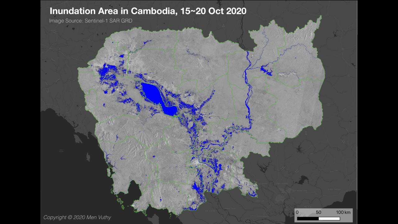
Detecting Flood in Cambodia in October 2020 from Sentinel-1 SAR
Our GIS consultant engineers master the geo-spatial information production chain, with GIS references all over 30 countries.